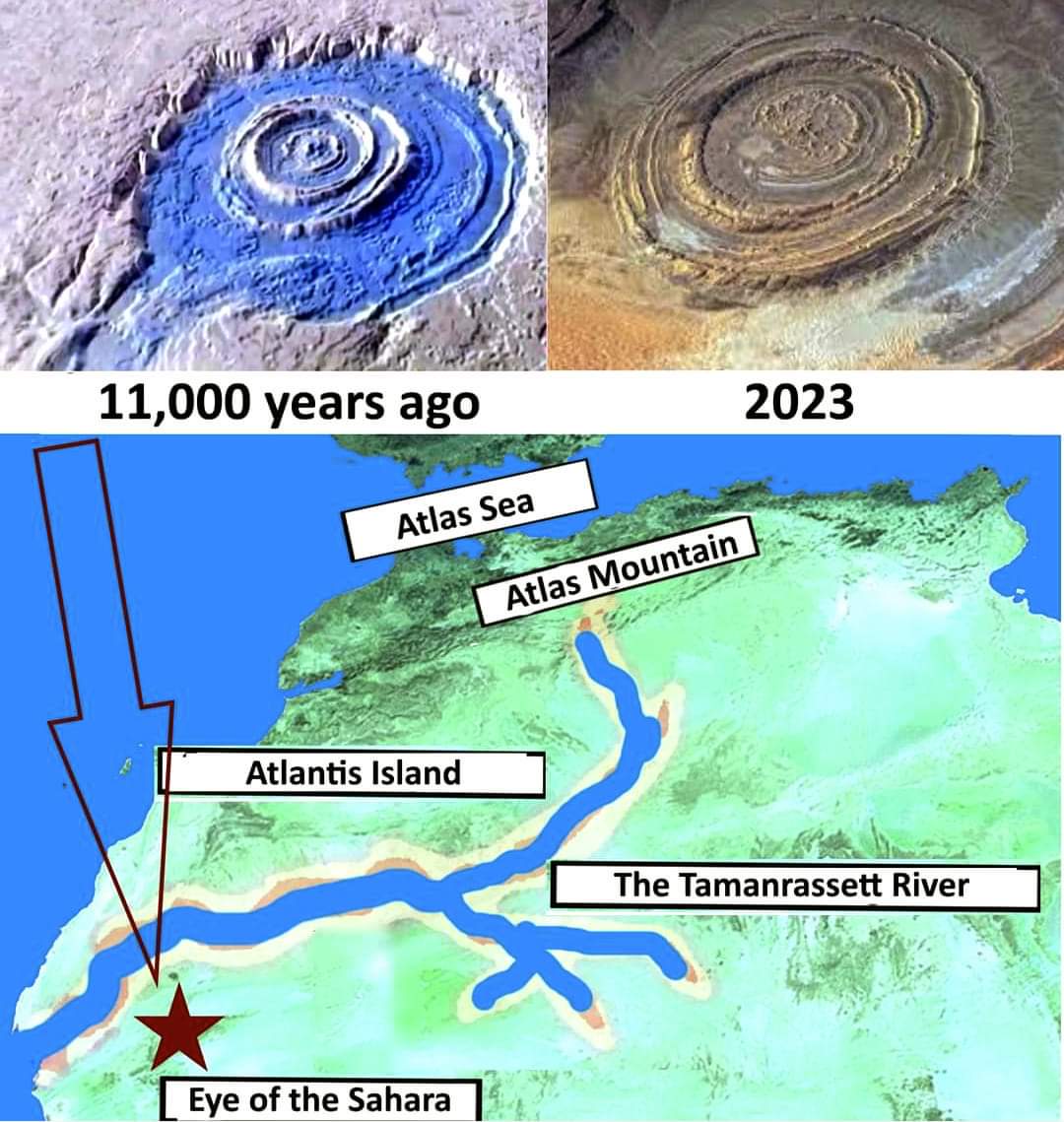
아틀란티스의 수수께끼를 해결했습니다.
...
아틀란티스의 신비는 더 이상 신비가 아닙니다. 그리스 철학자 플라톤이 이집트의 사제들이 사이즈에서 들려준 아틀란티스의 이야기를 인용한 이야기는 우화가 아니었다. 이집트인들은 그리스 철학자에게 부분적으로는 (1) “큰 섬”에, 부분적으로는 (2) 대륙에, 부분적으로는 (3) “큰 섬”과 대륙 사이에 가까운 거리에 놓여 있는 일련의 작은 섬에 살았던 사람들의 존재에 대해 말했다. 이 모든 것은 “헤라클레스의 기둥” 근처, 즉 지브롤터 해협 근처에 위치해 있었다.
...
모래와 물 아래까지 볼 수 있는 현대 위성 덕분에, 우리는 이제 7,000년 이상 전 모로코와 알제리 사이의 아틀라스 산맥에서 거대한 강이 시작되어 모리타니 해안으로 흘러들었다는 것을 알고 있습니다. 강은 넓고 길어서 작은 내해라고 볼 수 있었다. 이 강은 실제로 북아프리카 해안의 일부를 잘라내 일종의 “큰 섬”을 만들었다(비록 본토와 잠시 연결되어 있었지만). 아틀라스 산 기슭에 위치한(이 이름을 아직도 유지하고 있음) 주민들은 아틀란테안이라고 불렸고, 그들이 살던 땅은 “아틀란티스”라고 불렸다.
...
이야기에 따르면 대륙 부분은 “빅 아일랜드” 맞은편에 위치해 있었다. 따라서 스페인, 특히 카디스였다. 카디스 지역은 플라톤이 아틀란테아인들의 영역으로 직접 언급하고 있다. 몇몇 학자들은 이미 카디스를 플라톤이 언급한 사람들이 살았던 “헤라클레스의 기둥 너머” 지역으로 파악했다. 사실 그리스나 이집트에서 온 카디스에 가려면 지브롤터 해협을 건너야 합니다.
...
"빅 아일랜드"(즉, 모리타니 해안)에서 본토(즉, 스페인)로 이어지는 작은 섬들은 카나리아 제도였다. 약 14,000년 전에 시작된 빙하가 물을 110미터 이상 끌어올렸기 전에는, 이 섬들이 훨씬 더 많았고, 실제로 모리타니 해안에서 스페인으로 이어졌습니다.
...
그러나 이 설명은 큰 미스터리를 열어줍니다. 어떻게 사이스의 사제들이 빙하가 녹기 전인 약 14,000년 전의 아프리카 대륙의 지리를 알고 있었을까요? 사라진 문명은 시간이 지나면서 잃어버린 이 지식을, 이제는 위성 덕분에만 알게 된 지식을 어떤 것이 전해주었을까요?
...
그 기사는 책에서 계속된다.
호모 리로딩 - 지난 75,000년의 숨겨진 역사.
출처 : https://www.facebook.com/share/1DfFMkgNzA/
로그인 또는 가입하여 보기
Facebook에서 게시물, 사진 등을 확인하세요.
www.facebook.com

SOLVED THE MYSTERY OF ATLANTIS
...
The mystery of Atlantis is no longer a mystery. The story quoted by the Greek philosopher, Plato, citing the story of Atlantis as told by the Egyptian priests of Sais, was not a fable. The Egyptians had told the Greek philosopher about the existence of a people who dwelt partly (1) on a “Big Island,” partly (2) on a continent, and partly (3) on a series of smaller islands that lay at a close distance between the “Big Island” and the continent. All this was located near the “Pillars of Hercules,” that is, near the Strait of Gibraltar.
...
Thanks to modern satellites that can look even beneath the sand and under the waters, we now know that more than 7,000 years ago a gigantic river originated in the Atlas Mountains between Morocco and Algeria and flowed into the coast of Mauritania. The river was so wide and long that it could be considered as a small inland sea. This river actually cut off a piece of the coast of North Africa, creating a kind of “Big Island” (although it was connected to the mainland for a bit). Being located at the foot of Mount Atlas (which still retains this name), the inhabitants were called Atlanteans, and the land on which they lived was named “Atlantis.”
...
The continental part was located, according to the story, opposite the “Big Island.” It was therefore Spain, and specifically Cadiz. The region of Cadiz is mentioned directly by Plato as an area of the domain of the Atlanteans. Several scholars had already identified Cadiz as the area “beyond the Pillars of Hercules” where the people mentioned by Plato lived. To get to Cadiz, in fact, coming from Greece or Egypt, one must cross the Strait of Gibraltar.
...
The small islands that led from the “Big Island” (i.e., the coast of Mauritania) to the mainland (i.e., Spain) were the Canary Islands. Before the deglaciation that began about 14,000 years ago, which raised the water by more than 110 meters, these islands were much more numerous, actually leading from the coast of Mauritania into Spain.
...
This explanation, however, opens up a great mystery. How is it possible that the priests of Sais knew the geography of the African continent as it was about 14,000 years ago, before deglaciation? What vanished civilization had handed down this knowledge that had been lost over time, and which we now know only thanks to satellites?
...
The article continues in the book:
HOMO RELOADED - The hidden history of the last 75,000 years.